Engineering geology
Mineral Resources Tasmania (MRT) and the former Department of Mines, have undertaken activities in the field of engineering geology and groundwater for many decades. However, in more recent times groundwater (hydrogeology) functions have been transferred to another agency and the engineering geology tasks are more focussed. MRT currently employs two geologists addressing engineering geology and natural hazards in the state. This work is supported by other staff that provide information management, cartographic, laboratory and drill core library services.
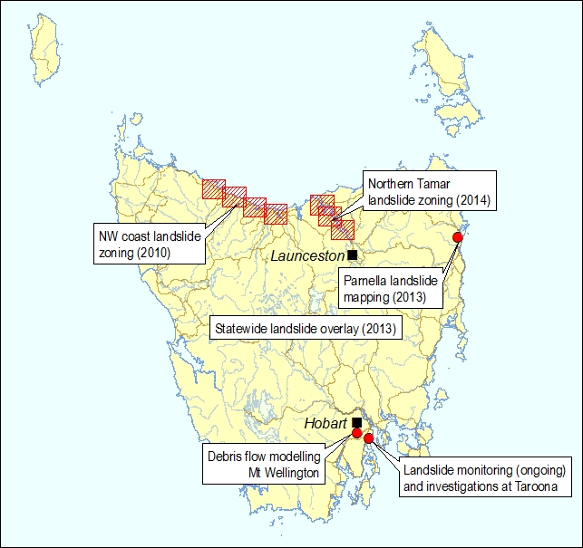
Currently the majority of the work this section undertakes is focussed on landslide hazards, particularly on the production of the Tasmanian Landslide Map Series and developing the MRT landslide database. This information is mainly being used for land use planning and emergency management purposes in the State. In addition MRT has had a long association with monitoring and studying active landslides, particularly at Taroona, and works closely with key stakeholders to understand and manage the risks at these sites.
The section is actively involved in managing engineering drill hole data and associated drill core, a database of laboratory analyses of engineering tests, the landslide database and associated images, maps/plans and reports. It routinely fields questions from other sections of MRT, other government agencies, geotechnical practitioners and the public for advice on a variety of matters. The section also provides specialist services to other parts of the agency including LiDAR processing and GIS programming.
There are several organisations addressing geological hazards in the State beside MRT, either at State or Federal level. For instance earthquake monitoring and zonation is undertaken by Geoscience Australia while tsunami alerts are issued through the Bureau of Meteorology. However, MRT is often requested to interpret this information at a local level. Within the emergency management functions of State agencies, MRT is nominated as `having primary responsibility for management of landslide and other geological hazards from a state research and policy development perspective' (2012 Tasmanian State Natural Disaster Risk Assessment, Department of Police and Emergency Management).