Erosion control works completed at Anchor mine
Erosion control and rehabilitation works have been completed at the historic Anchor Tin Mine site, located approximately 1.2 km southwest of Lottah in north-east Tasmania.
Tin mining at Anchor began in 1895, where a processing plant powered by a large water wheel was capable of crushing up to 300 tonnes of tin-bearing ore per day (below). The site experienced multiple periods of activity and ownership over more than a century before ceasing operations permanently and formally closing in 2001.

Waterwheel, Anchor Tin Mine, North East Tasmania (1913) – Walker, James Backhouse (Sourced via the University of Tasmania Library Special and Rare Materials Collection).
Following closure, initial rehabilitation works were undertaken, including sealing underground workings, dismantling and removing the concentrator and clearing site waste. The tailings dam wall was also stabilised and recontoured, and disturbed areas were seeded and fertilised. Since then, tall forest vegetation has re-established across most of the former mining footprint, with only a 0.5 hectare section associated with the tailings dam remaining largely unvegetated.
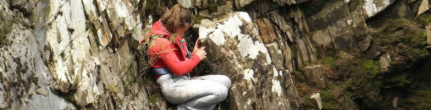
In response to ongoing community concerns regarding the stability of the tailings dam embankment, Mineral Resources Tasmania (MRT) began undertaking routine monitoring and inspections of the site. In 2023, survey prisms were installed to track potential movement of the tailing’s embankment, with subsequent analysis confirming the underlying stability and condition of the embankment. MRT’s inspections identified localised surface erosion across approximately 3,000 square metres of the tailing’s embankment batter, and evidence of sedimentation into the surrounding forest and the Groom River - in particluar after significant rainfall events.
In 2024, MRT engaged LMRS Pty Ltd to apply 100 kg of NPK fertiliser to the tailings batter to promote the establishment of moss and small vegetation, with the objective of improving surface stability.

Pictured above is the rill erosion evident on the Anchor tailings embankment (May 2026).
Given the risk of continued erosion and the potential for adverse environmental impacts on the Groom River, MRT completed further erosion control works at the historical Anchor Mine site in May 2026.
Contractor LMRS Pty Ltd was again engaged to undertake targeted surface stabilisation measures, focusing on water diversion and repair of erosion damage. The works included earthworks to reshape the embankment, installation of surface erosion control matting, placement of slash material and revegetation.
Earthworks were first carried out to smooth the batter face following the existing profile, and erosion channels were infilled using on-site material. Open-weave jute matting (500 gsm) was then installed across the full extent of the slope to provide immediate surface and soil protection surface and reduce further erosion.

Pictured above are the earthworks and the installation of geofabric on embankment slope (May 2026).
To support vegetation establishment and embankment stability, NPK fertiliser was applied across the site. Fast-growing species, including Secale cereale (rye corn) and annual ryegrass (Lolium Sp.), were sown to provide rapid short-term vegetative cover, reduce erosion risk and contribute organic matter. Using these annual species ensures there is no long-term persistence in the soil bank.
Native perennial species were also sown to support long-term stabilisation. These included shallow-rooted colonising plants such as Poa and Senecio species, along with planted Poa labillardierei tubestock.
Additional stabilisation measures involved placing locally sourced woody debris (slash) across the embankment. This material helps anchor the matting, create microhabitats, and further reduces surface runoff.
Works were constrained to the existing footprint of the mine’s historical disturbance.

Pictured above is the locally sourced slash and its installation on embankment slope (May 2026).
All works were scheduled outside the raptor breeding season and conducted in accordance with the NRE Tasmanian Wetlands and Waterways Works Manual. Environmental considerations were made due to observations of raptor species, such as the grey goshawk and wedge-tailed eagle, as well as the potential habitat of Hydrobiid snails.
MRT will continue to monitor the site to assess rehabilitation outcomes. Ongoing evaluation will include drone-based photogrammetry and water quality monitoring, with additional weed management activities planned for the 2026–27 financial year.
This project was funded under the Rehabilitation of abandoned mining lands trust fund (RTF). An annual report of Trust Fund activities is produced by MRT, and the next edition is scheduled for release in July 2026. Rehabilitation projects are also regularly highlighted in the monthly MRT newsletter. Further information about the Rehabilitation of Mining Lands Trust Fund, and the MRT newsletter can be found via the MRT website at https://www.mrt.tas.gov.au or by contacting MRT directly via email on info@mrt.tas.gov.au. |