Scamander 3D model release
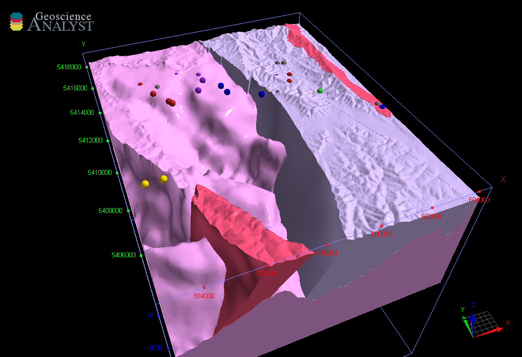 The Scamander 3D geological and geophysical model extends to a depth of 12 km within the area depicted. It expresses a synthesis based on geological mapping together with geophysical and structural interpretations previously produced by MRT and other geoscientists over several decades. The model is constrained by 3D geophysical modelling using MRT's gravity and magnetic survey data coupled with drilling and rock physical property databases. This information has been used to derive uncertainty estimates for each element in the model volume. The model files also include nominal density and magnetic susceptibility estimates obtained for each voxel, thus incorporating intra-unit variations.
The geological model was constructed using the GOCAD® Mining Suite from Mira Geoscience, with initial geophysical inversions via the VPmg code. Further geophysical modelling and sensitivity characterisation was carried out with the GeoModellerTM software from Intrepid Geophysics.
The Scamander 3D model is being distributed as a Geoscience Analyst project. Geoscience ANALYST is a visualisation and communication software for GoCAD® 3D models, made freely available by Mira Geoscience.
The Geoscience Analyst software, Scamander 3D model project and explanatory notes are available for download using the following links:
https://mirageoscience.com/mining-industry-software/geoscience-analyst/
For further information please contact Daniel Bombardieri or Mark Duffett.